Last months travel diary ended with us exiting Argentina, having spent a very enjoyable 3 weeks driving approximately 1200 Km of Ruta 40 from Mendoza southwards to Bariloche. Chile is very strict with regards the importation of food, specifically vegetables and meat products and as this was our first entry we had very little idea what to expect and were to an extent dreading it. The agricultural agents were very friendly but very thorough in their search and before driving away we had donated a number of items to their dustbin, despite thinking we had minimised what could likely be taken.
With Mr Jones a little lighter, we left the border and headed for the nearest town, Osorno, hoping to restock our groceries, withdraw local currency and find a SIM card. After much searching and multiple stops, we had successfully the first two task but with regards the 3rd we had frustratingly failed. Osorno was quite large, not particularly attractive and offered little in the way of camping so we continued southwards to the smaller town of Frutilla, which sits rather picturesquely on a lake with the towering snow-capped Volcano of Osorno overlooking it. Our experience has been that it is often easier to find items like SIM cards or good butcheries in the smaller towns, perhaps just simply because it is easier to navigate and there are less options and so the following morning we parked Mr J in a side street and set off in search of the elusive SIM. We did ultimately come right but it still took the better part of the morning to find a shop that could assist but at least this gave us a good opportunity to wander the Main Street and along the way find a nice butchery or two and therefore also restock Mr Jones freezer.

Usually the next challenge once you have obtained a prepaid SIM card is how to load data onto it, for some strange reason in both Brazil and Argentina you can’t use a foreign credit card and need to do it in person in a store (usually different to where you buy the SIM) but thankfully Chile is more advanced in this regard and everything could be done online. AN IMPORTANT NOTE, for anyone reading this blog and about to enter Chile: Chile requires all cellphones which connect to their cell/mobile network to be registered within 30 days of first connection, failing which they block the cellphone (IMEI number of the phone) from using the network! See our Practical Information page for the process required to do this.
With data on our phone and meat in the deep freeze we were free to continue the journey which meant making a short hop of 50km down to Puerto Montt and the official start of the Carretera Austral where we camped on a stoney beach just outside of town. This was our first sighting of the pacific and as we had read that the tide movement was quite large in this part of the world we camped well back and above what we thought was any evidence of the high-water mark. In fact, we weren’t far enough back and were most grateful to the drunken teenagers who arrived at 2am and woke us up with their revelry, as when we looked out the window to see what was going on we discovered that the sea was only metres from Mr Jones. Needless to say, we hastily packed up and moved a bit further away while cheerily greeting the youngsters, it’s not often you are thankful to be woken at an ungodly hour so may as well be nice about it…


The Carretera Austral translates in English to the Southern Highway and creates a land link for the section of Chile Patagonia which is sandwiched between the Andes in the East, the Pacific Ocean with its complex array of Fjords and steep mountains in the west, the Great Patagonian ice field in the South and the Pacific Ocean below Puerto Montt in the North. In total it is 1200km long and was built to provide land access to the roughly 120 000 population (of which roughly 2/3 live in one town) that calls this region home. Prior to its construction the only possible land access was from a couple of points in Argentina which for the dictatorship of General Pinochet was an unsatisfactory situation. In 1976 the army began construction and it opened to traffic in 1988 although it still took 14 years for the final 200km to be built. Highway is an optimistic name for it, as in reality roughly half remains dirt and the other half single lane tar. There is a strong rivalry between Argentina and Chile with regards to whether Ruta 40 or Careterra Austral is the most beautiful – having driven the bulk of both we consider Argentina the clear winners, simply due to the significantly greater variety of scenery and landscapes along the entire route.
Even though the “highway” officially starts in Puerto Montt, within the first 200km you need to catch two ferries.
The first ferry crossing is a relatively simple one which requires no logistical planning as you just drive up to the dock, pay upon boarding and 30 minutes later are deposited on the Hornopiren peninsula where if you are slow like Mr Jones then get to enjoy (after having been overtaken by most of the other ferry riders) a slow and scenic drive across the peninsula to the small town of Hornopiren which is the launch point for a much hour longer ferry. As we were not yet in peak season there is only one sailing per day, which is early in the morning therefore almost everyone appears to need to spend a night in town. Apart from what appeared to be some commercial salmon farming the only other reason the town appears to exist is to accommodate the following days ferry passengers. We had read that this second ferry got very busy and that it was advisable to purchase your ticket in advance so we had tried the day before to do this online via our phones and always got the result that it was fully booked, even for departures 2 weeks away…. Failing to see how this was logistically possible, especially as it was not yet peak season, we had proceeded this far assuming that the town would have a functioning ticket office but upon arrival discovered this was not the case! While wondering what our next move could be, Stuart had the thought to try access the booking website from our laptop instead of from a phone – we have in the past experienced that some websites just don’t work very well when accessed from a mobile device which was exactly the case here and thankfully we were able to purchase a ticket for the following morning’s sailing.
We had read many articles which claimed the ferry ride was a great opportunity to spot whales, dolphins and other sea creatures from the deck of the ferry, all while marveling at the magnificent scenery you are sailing past. The views are quite spectacular but generally not very varied so you quickly become accustomed to steep heavily forested hillsides running down onto a stony shoreline and lots of wide-open expanses of blue water and of course it is pretty windy on deck as the ferry steams along and bitterly cold. So, in fact what we experienced was passengers either stay inside and doze or sit outside in the sun on the leeward side of the vessel and doze while trying to soak up some warmth.


After 5 hours on the ferry, which included quote a prolonged period of rock and rolling, we docked at a tiny little bay known as Caleta Gonzalo which appears to have no other purpose than being the point where the ferry stops. Everyone’s departure from the ferry was further delayed by 30 minutes as we watched from our vehicles the evacuation of an unfortunate passenger who must have fallen during the rough sea section. Sitting watching the spectacle unfold we couldn’t figure out why they didn’t let everyone disembark before bringing the ambulance onto the ferry until we touched terra firma and immediately began chewing the dust of those in front of us. It is 60km from the disembarkment point to the town of Chaiten where no doubt most planned to stay and all of this is on a narrow dusty dirt road hemmed in by very tall dense forest which meant the dust just did not disperse. This section traverses Parque Pumalin and we had intended to take it slow and camp in a few of the national park campsite along the way, so when we got the opportunity after 15km to pull off and leave those in front and behind us to lead the charge we gladly did. The pull-off point was the start of a short hiking trail into the forest to view a number of ancient Alerce trees which are like the giant redwoods you find in the USA.


After an hour of wandering through the forest, marveling at not only the Alerce trees but also how dense the forest was we returned to Mr Jones and set off for a campsite. In last month’s travel diary, we mentioned that one of the reasons for us delaying our entry in Chile was that the national parks rangers had been on strike which made accessing most of the parks either extremely difficult or just downright impossible, in theory now the strike was over but as we soon discovered nobody’s had yet been along and removed the chains blocking access to the various campsites dotted along the road. Perhaps though this was a blessing in disguise, at least for that night, as we found a lovely little spot just off the road which overlooked a beautiful lake and sunset and as an added bonus had a strong stream just next to it meaning we had a plentiful water supply for a hot shower later. And as most of the vehicles from the ferry had already charged off into Chaiten we had a perfectly peaceful night with no traffic passing.


A chance stop, the following morning at parking area which appeared to have some information boards resulted in Stuart making the impetuous decision to hike up the Chaiten volcano, Tania wisely stayed with Mr Jones. Not having done any hiking for an awful long time, perhaps he should have read some of the older reviews on iOverlander more carefully which mentioned that the trail was more like a set of one very long and giant steps which ascended over 600m in roughly 3km! The volcano last erupted in 2008, spewing ash 17km into the atmosphere and forcing th evacuation of roughly 5000 residents in the nearby town of Chaiten.


Two hundred kilometres south of Chaiten is the Queulat Glacier National Park famed for its large hanging glacier which supposedly can be viewed after a relatively short hike but once again we stumbled into access issues. This time the park was open although not on the Monday afternoon when we arrived, for some strange reason it only operates Tuesday to Sunday and then to further complicate the process you are required to purchase your access ticket online in advance which we only discovered at the gate and naturally there was no cellphone signal in the area so we spent a fair bit of time driving up and down the Ruta 7 searching for both a campsite and either cellphone signal or a useable Wi-Fi signal. When we did eventually get a connection, the booking website would, as with the ferry website, not work properly on a mobile device. At this point, after experiencing closed campsites the previous days and now needing to jump through multiple hoops to enter a park our desire to pay money to walk a muddy trail in order to view a large block of hanging ice from afar was rapidly diminishing especially when you can’t help yourself and draw comparisons to the ease of access we had enjoyed for similar parks in Argentina. When it rained quite heavily overnight which would only serve to make the trails muddier and the glacier was covered in low cloud in the morning, it was an easy decision to decide to skip this attraction and move on south. The glacier could be viewed from the campsite the evening before so we didn’t totally miss out on the opportunity to view it.
One thing we had so far come to realize from Ruta 7/ Careterra Austral is that there are very few diversions off it, so when a cycling couple in the glacier view campsite told us/raved about a 150km loop which they had done a bit further south we decided to make the diversion and hopefully find a few wild campsites along the way in order to make it a multiple day diversion. As with everything in life, we all have different perspectives and while the route was lovely and quiet, the scenery in our opinion was average and if travelling with a vehicle there were zero opportunities to wild camp as fences ran along the entire route. Roughly halfway into it, we did find one possible option but it was on top of a windswept hill and would really not have been very restful so we continued on until we joined back on to Ruta 7 and could continue on to the town of Coyahaique.
With a population of 60 000 inhabitants, Coyhaique is the largest town along Ruta 7 and therefore had a reasonable sized supermarket where we could stock up on essentials, remembering that we had run our fridge and freezer really low in order to be able pass Chile strict border controls. Other than shopping there was no reason to hang around and so having re-stocked we continued to the southward journey towards the next “big” attraction, being Vila Cerro Castillo, in fact it is not the village that is the attraction but rather the mountain Castillo which towers over it with its jagged peaks which resemble a castle. By this time, we were desperately hoping to find somewhere that could hold us for a few days while we enjoyed the scenery as we had been constantly on the move for a while, at this point. It was also the day of the World Cup soccer opening ceremony and game and being in soccer mad South America we thought it would be easy to find a bar with a TV, in fact the only tourist attractions were a few small hotel type establishments and a very bleak looking campsite which had no real protection from a gale force wind which was honking outside. In the meantime, we had also discovered that the hike leading up to the main view point of Cerro Castillo was partially closed as the winter snow had yet to fully melt which meant that even if Stuart had wanted to do the hike it was simply not an option. And so, we once again moved on South.
Thankfully only 50km out of the village, down a small side track we found a nice camp spot next to a river which was sufficiently far from the dusty Ruta 7 that we could pass away the rest of the afternoon in peace and quiet and dust free. As already mentioned with very few opportunities for branching off to smaller attractions, the Carretera austral was very much becoming a case of breaking it up into stages of going from one main attraction to another. Next on the list was Rio Tranquilo and the nearby marble caves which abut into the lake and can only be accessed by kayak or rubber dinghy. The pictures we had seen looked quite spectacular and we were quite keen to take a tour, the weather however had other ideas as the wind had not died down from the previous day and in addition it was cold and rainy – all 3 of which do not make for a nice tranquil trip along a lake to some caves. The weather forecast did not predict a letup in the conditions for a few days and there were no attractive paid camping options in town, so once again we moved on south in search of another wild camp for the night, ideally somewhere that was tucked away from the wind which thankfully we found and it had a great view of an unknown hanging glacier.
We had now reached a point on the Careterra Austral where a decision needed to be made with regards the direction to take, we could either turn east and head back into Argentina or we could continue south to the end of the road at Vila o Higgins with perhaps a side diversion to Caleta Tortel (a village, with no roads, that is built on stilts above a fjord). The problem with the second option was that it is dead end journey of 300+km meaning you have to return the same way in order to eventually exit to Argentina. Up until this point, while we had enjoyed parts of it, ultimately the Careterra Austral had not rocked our boat and so we opted to skip the 600km round trip and rather exit to Argentina.
The route to Argentina follows the southern shores of Lago General Carrera (South America 2nd largest lake with a length of over 200km and a surface area in excess of 1800 square kilometres) and for us was the highlight of the Careterra Austral even if it is officially not part of it. The views were stupendous all the way as the road wound its way up and down and around the shoreline often clinging to cliff edges – think Chapmans Peak drive, just longer, more remote and all on dirt.


We arrived in the border town of Chile Chico in the late afternoon and as we weren’t expecting an onerous process decided to cross immediately, unfortunately for us we got what appeared to be a very new and strict Argentinian official who was intent on searching Mr J and finding animal or other prohibited biological products. We were well aware of the strict controls Chile applied as mentioned earlier in this diary entry but until this point had not heard of a single traveller encountering issues when entering Argentina, needless to say the official found items to confiscate including for some bizarre reason our muesli! To add insult to injury he then followed protocols to the T and left us waiting for about 45 minutes while he painstakingly typed up an affidavit to state what had been confiscated. What was meant to be a quick and easy border crossing turned into a rather complicated one and we could only proceed once the affidavit was complete and Stuart had signed it in triplicate. Thankfully there was a cheap and cheerful municipal campsite in town which was wind protected and so it was an easy decision to spend a couple of a nights and recuperate a little from our brief jaunt through Chile.
During our rest day, Tania had spotted a tourist attraction sign for route that hugs the Chilean border on the way south and so instead of heading over to the possibly faster and well-travelled Ruta 40 we opted to take this Ruta 41.
It was a great choice and the Parque National Patagónia pamphlet we picked up after completing the loop describes it perfectly: “Ruta 41 – Majestic scenery characterizes the most diverse and unexplored road in Patagonia. Incredible views of the steppe, rock formations, southern beech forests, lagoons, meltwater waterfalls and the unbeatable view of the Andes mountain, added to the sightings of condors, black necked swans and countless birds make the route an unforgettable experience”. And to round off a perfect day, we ended up at a cute little (and free) campsite within the National Park which was thankfully quite wind protected and had a few small walks we could do the following day. The rangers seemed quite surprised to see us, as it seems they don’t get many visitors and asked us to spread the word about their “spot”, so if you happen to find yourself in Parque National Patagonia please do try to stop at Portal El Sauco…


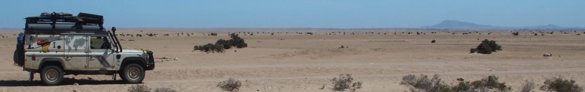
After leaving the park and joining Ruta 40 we got our first introduction to the famed winds and long boring barren sections of the Patagonian steppe where the tallest plant is no higher than calf high (anything taller would probably get blown away) and the fences lining the road are littered with corpses of Guanaco’s ( a relative of both the lama and camel) where they appeared to have failed in their attempt to jump over the fence and have most likely broken their necks when getting snagged on the barb wire. What did amaze, bewilder and astonish us over the next two days, as we and Mr J battled the winds and boring roads, is the number of cycle tourists that we encountered, there must surely be more pleasurable ways of self-flagellation than peddling a heavily loaded bicycle into relentless head and crosswinds?


The reward at the end of a long two days, the little town of El Chalten which sits below the soaring peaks of Fitzroy, Cerro Torre and others. We were in town for the scenery but also so that Stuart could do the hike to the glacial lake at the base of Fitzroy which is supposedly one of the best day hikes to do in Patagonia. Despite El Chalten being a 100% tourist town and that most visitors are either climbers or hikers there are surprisingly only two camping options, one being an organised and expensive site in town and the other being a large and free parking area just at the entrance to town, we opted for the latter and joined an eclectic bunch of international overlanders which made for some nice and interesting chats over the next few days while we waited out a bit of bad weather. On the 4th day, Stuart was up early as the weather was predicted to be okay and set off for the round-trip hike of 25km which was perhaps a bit further than sensible when you haven’t done any serious hiking for many year, especially as the last kilometre to the base of Fitzroy ascends 400m in just 1km! Going up was fine and he made good time but the return 12,5km was a rather painful experience as his old ITB issues kicked in which made every bend of the right knee a painful one.


The day of his hike was also the day Argentina was due to play Holland in the soccer World Cup and so we had made arrangements that assuming he would be able to get back into town in time we would meet at a pub to watch the game. To co-ordinate our meet-up we had a simple plan – when he had 3km left of the hike he would send a message using the Satellite GPS device we have, confirming where to meet up. With just over an hour to go until kick-off the message was sent and received along with one extra requirement: Bring painkillers!
Under normal circumstances, 3km of downhill should take 30minutes or less, so Tania had to hustle to close up Mr J and walk into town herself. Needless to say, she spent a good 30 extra minutes sitting outside the pub wandering if we had somehow missed each other until a rather weary Stuart limped up the main road from the trailhead. Given that most of the town’s population seemed to be tourists we had underestimated how busy the pubs would get for the game but did eventually find a small local pub where we could stand just inside the door and watch the game. In the end though we only saw the first half as the legs, despite the recently swallowed painkillers, were a little too tired to stand through the entire game but there was no doubt who had won when an hour later we heard all the hooters and revelry coming from town. Vamos Argentina!
Once a month or thereabouts there is always a need to stall somewhere while you get admin tasks done such as laundry, haircuts and small maintenance items that invariably accumulate. Having accomplished what we had come to El Chalten for, we moved on south to the larger town of El Calafate. In Brazil we really enjoyed being able to park off for a few hours at a self-help laundromat while we ran a few loads through the washer and dryer but have yet to stumble across such facilities in this part of the world. As we had driven into town late on a Saturday, it meant the laundry wouldn’t be ready for collection until Tuesday so we had plenty of time to steadily work through our other tasks and to organise money.
As we have mentioned in previous travel diaries, Argentina’s economy and hyper-inflation has created a semi-formal black-market exchange rate mechanism, known as the “Blue Dollar”. Rumors had been abounding for the last month that the government had reached an agreement with the credit card companies to charge transactions by foreign credit cards at this rate, which would certainly make life easier for us and for the government as it probably would help to formalise tourism related income and bring it into the taxable net however no traveler reported actually being charged this better rate when using their card. El Calafate is a small town with lots of tourists passing through, all wanting to do exactly the something – “obtain double their money via Western Union” which meant that the only two WU outlets in town had long queues (4+hours) and had a restriction on the amount a person could obtain, effectively ZAR3,5k. We joined the queues twice over the course of a few days, only to discover a few days later that the blue rate was finally working on credit cards!
Once we had the bulk of our admin tasks completed it was time to head 70km out of town to its main tourist attraction, the Perito Moreno glacier. The glacier is huge at 30km long and at its end, it is roughly 5km wide and 70m high and incredibly one of the few glaciers in the world that is not shrinking due to global warming. Conveniently it ends directly in front of a hill which has allowed the authorities to build a maze of walkways which allows very convenient (and sustainable) access to the thousands that pass by each day. While standing on these walkways you hear the glacier creaking and groaning as it steadily advances at microscopic pace and if you are incredibly lucky you may be there when a giant chunk of ice breaks free from the face and plunges into the lake with a giant splash. Naturally there are also many other activities available, if you so desire, such as boat and kayak trips on the lake below the glacier or treks on the glacier itself where you don some crampons and shuffle in big groups across a carefully laid out route on the glacier. We are not really big fans of such mass tourist destinations where it inevitably feels like you are surrounded by people who are more concerned with snapping a selfie to prove they have “been there, done that” before they quickly move on to the next big thing, after a few hours we decided to skip the curio and coffee shop and rather take lunch next to Mr Jones before heading back to town.


Our time in El Calafate coincided with the World Cup soccer semi-finals and as in a week prior our search for a place to watch Argentina beat Croatia resulted in us enjoying standing room just outside a bar, except this time one of us was not suffering from tired legs and so we got to watch the whole spectacle and subsequent street celebrations when Argentina advanced to the finals. The atmosphere was so great and the similarities of a country desperately needing hope and something to be proud of reminded us so much of South Africa and the 1995 Rugby World Cup that we decided there and then to stick around for the final, instead of continuing south as we had originally planned. We however didn’t want to hang around in town for all that period so instead drove back out towards the Perito Merino glacier and a free campsite within the National Park called El Huala where we passed away a very pleasant 3 days with distant views of the glacier and surrounding mountains.
For the final game we thought we would be clever and hit the bars 90 minutes prior to kick-off, pretty sure that that way we would be able to find a table and seat but alas we totally underestimated the enthusiasm of both locals and tourists and ultimately found ourselves back outside the door of the “semi-final” bar. For us it wasn’t a train smash as we were there to lend a little bit of support while soaking up and enjoying the atmosphere. It was a great final game full of suspense after Argentina first took a convincing 2-0 lead, then France come back in the second half to level everything which ultimately resulted in penalties which thankfully Argentina prevailed over. And as expected the celebrations were huge and great to witness.


Leaving town a day later, while filling up with diesel and testing our credit card to see if the blue dollar rate did in fact apply we allowed Mr Jones to “pay it forward”, first by jump starting some Chileans who had car problems and then by picking up a French hitchhiker. The hitchhiker was heading to El Chalten and we were continuing south hoping to cross back into Chile later in the day, so 50km later we dropped him off at the junction that heads north and wished him good luck in finding his next ride.
The border crossing would bring us back into Chile just outside the Torres del Paine mountain massif and we were still debating whether to do a loop through that national park or to just continue the southward journey to Ushuaia and the “end of the world” but that is a story for the next diary entry.
As usual below you can find links to other parts of the blog which complement the travel diary:


Gallery: Chile (Careterra Austral)


Practical Information: Chile (help & advice regarding border crossing and requirements regarding cellphone usage in Chile)

Overview of overnight locations and therefore route travelled

Maintenance Log (everything it takes to keep Mr Jones purring)
Discover more from HippySquared
Subscribe to get the latest posts sent to your email.
That was a loong post, and very interesting for us, since we drove almost the same route, reversed. Nice to read someone else’s perspective. Can’t wait to read your next post!
Thanks Rieneke, in the some way we enjoyed reading about your experience and in particular the marble caves tour which we missed due to bad weather.
Delightful and riveting reading. (Great information for anyone planning!)
Thank you, means a lot coming from such a well travelled couple